#1 Costa Rica Travel in Paradise, Costa Rica Vacations |
|
|
||||||||||||||||
|
Home| Escorted Trip | Family Trip | Honeymoon |Tailor MadeTours | Rent a Car | Hotel | One Day Tours| About C R| Testimonial | FAQ | Contact Us | About Us | Terms| How to Book
|
||||||||||||||||
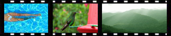
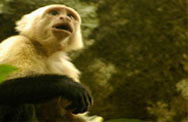
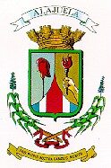
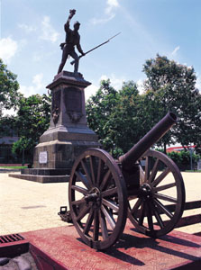
Climate: Many associate Alajuela with the warm and sunny climate that characterizes the city of the same name and the various towns in the western end of the Central Valley that also belong to this large and populous province. However, the vast majority of the provincial territory lies on the other side of the volcanic cordilleras, extending north to the Nicaraguan border. This sprawling area in the northern lowlands is under the influence of weather conditions coming in off the Caribbean Sea and was formerly covered in extensive tracts of majestic rain forest. Recent agricultural colonization of the northern frontier has severely altered the natural landscape (witness the paucity of national parks in the region), and very likely has affected the climate to some degree, resulting in hotter and slightly drier conditions, even though this is still an area of high annual rainfall (local inhabitants claim it rains 13 months out of the year). Even wetter, and much cooler, conditions exist along the Caribbean-facing slopes of the cordilleras, which reach a height of 2,704 meters above sea level on the summit of Poás Volcano. History: Following the establishment of the city of Cartago in the latter part of the 16th century, the incipient population began expanding westward. By the beginning of the 18th century, the population of Heredia had grown such that it became a second base of expansion, again to the west. To the Catholic colonists one drawback to founding new settlements was the inherent difficulty in attending mass when living far from the established towns. For this reason, in 1782, a new parish that included several small settlements scattered to the west of Heredia was formed in a site known as La Lajuela. Over time this place name evolved into Alajuela, which was also known as Villa Hermosa, "beautiful village." The settlement of the northern portion of this province only began in earnest in the later half of the 19th century, and even so did not reach great proportions until the second half of the 20th century owing largely to the difficult access. In fact, much of the original colonization (apart from that of the Botos tribes who had inhabited the region for centuries prior to the coming of the Spaniards) came not from Costa Rica, but from Nicaragua since numerous navigable rivers flow north from their origins in the cordilleras and empty into either Lake Nicaragua or the San Juan River. This natural geographic connection was used (and to some extent still is today) by people coming from Nicaragua in search of new land or for exploiting forest products (e.g., hunting, rubber tapping, and extracting ipecac root). In the last few decades, with an extensive network of all-weather roads constructed in this once isolated region, cattle and crop production have come to dominate the countryside and a thriving agricultural economy now exists which supplies much of the nation's corn, beans, and fruit and vegetable produce. National Parks: 1) Caño Negro National Wildlife Refuge 2) Arenal National Park 3) Poás Volcano National Park 4) Juan Castro Blanco National Park 5) Guanacaste National Park 6) Rincón de la Vieja National Park Other Points of Interest: 1) Topiary in town park of Zarcero: This picturesque mountain town lies 67 kilometers northwest of San José. At an elevation of 1700 meters, the air temperature is pleasantly refreshing. The principal attraction is the town square in front of the church with its amusing variety of forms and figures (elephants, monkeys riding bicycles, helicopters, etc.) that have been shaped out of ciprés, a common type of conifer planted at higher elevations around the country. For admirers of religious architecture, the church is well worth taking a look at. Taking the PanAmerican highway (Rt. 1) west out of San José, take the Naranjo exit and follow signs (or ask) for Ciudad Quesada. Zarcero is perched on the rim of the Central Valley (17 km. north of Naranjo) before you start to drop down to the northern plains of the San Carlos region. 2) Wood-working and painting in Sarchí: Around the turn of the 20th century, an artistic-minded person working for the La Luisa coffee mill, near the village of Sarchí, had the notion to paint colorful designs on the sides and wooden wheels of an oxcart. The idea caught on and eventually most Costa Rican oxcarts sported gay geometric designs. Nowadays, this veritable national symbol is becoming a vanishing species due to the greater speed and versatility of pick-up trucks and 4X4 vehicles. However, the production of hand-painted oxcarts is as prolific as ever--only now they come in miniaturized versions destined for the souvenir trade. The village of Sarchí has evolved into the center of this production and numerous shops dot the main road through town. Several of these souvenir outlets have back rooms where the visitor is welcome to enter and watch the local craftspeople at work as they paint the decorative patterns. The church in the center of town is also noteworthy. Painted in pastel shades of green and pink, it somehow looks more like a wedding cake than a church. The town is located 53 km. northwest of San José. Driving westbound on the PanAmerican highway (Rt. 1), take either the Grecia or Naranjo exits and follow signs (or ask) for Sarchí. The distance from the highway is less if you take the Naranjo exit, although this means driving a bit farther west and doubling back. 3) La Virgen del Socorro: This is an area at about 700 meters in elevation along the forested canyon of the Sarapiquí River that has been a favorite with birdwatchers and butterfly enthusiasts for many years. Prior to the opening of the road through Braulio Carrillo National Park, this was one of the most accessible mid-elevation Caribbean slope sites for those coming from the Central Valley. Many of the butterfly species found in this altitudinal belt have very limited geographic distributions. Among the birds, hummingbirds and tanagers are particularly plentiful and include the Black-crested Coquette, Green Thorntail, Coppery-headed Emerald (known only from Costa Rica), Crimson-collared Tanager, Emerald Tanager, and Silver-throated Tanager. The place name actually refers to an agricultural community that a gravel road and an old rusting iron bridge over the rushing Sarapiquí River link with the rest of the world. For the purposes of a natural history outing, all that you need do is park your car just off the paved road and stroll down the gravel road until you feel like turning around and hiking back up. The bridge makes a good goal if you need one, and in addition to being just an incredibly pleasant place to sit and watch the mountain stream, it's also a good place to find American Dippers and Torrent Tyrannulets, two bird species that favor this habitat. To get there, drive to Vara Blanca -- in the saddle between Poás Volcano and Barva Volcano -- and follow Rt. 9 north. About two kilometers beyond Isla Bonita, look for a sign welcoming you to La Virgen del Socorro and a sharp right-hand turn onto the gravel road (if you come to Cariblanco, you've gone too far). On the way down from Vara Blanca there are two magnificent waterfalls. The first comes thundering down right beside the road and can't be missed. This is known as Catarata de La Paz, since it is on the Río La Paz (Peace River), which originates near the summit of Poás Volcano. The second falls is farther from the road, but unless it is very cloudy, is not easily missed. Be looking down across the river gorge on your right as you come into the village of Cinchona, and you'll see this impressively high waterfall as it spills into the Sarapiquí River. A small roadside (former) restaurant nearby has a great view of the falls and also has put out several hummingbird feeders, so you can get some terrific close-up views of these swift creatures. 4) Fraijanes Recreational Park: This 18-hectare recreational park, located en route to Poás Volcano, was created by the Tourism Board (I.C.T.) in the early 1980's. It is a popular picnic area among the local populace, especially when the weather is less than ideal at the summit of the volcano. A small man-made lake forms the centerpiece of the park and a series of trails wind through the partly forested grounds. If the park is not too crowded, the birdwatching here can be productive with such species as White-eared Ground-Sparrow, Yellow-throated Brush-Finch, White-throated Spadebill, Steely-vented Hummingbird, and Greyish Saltator in residence. The park is located 15 km. north of Alajuela, on the road to Poás Volcano National Park, and is open from 9:00 a.m. to 3:00 p.m., Tuesday through Sunday. There is a small entrance fee and charge for using the parking lot. 5) Juan Santamaria Museum: Located one block north of Alajuela's Central Park (across the street from the Credomatic office), this museum is dedicated to the historic events that occurred in the mid-1850's when William Walker attempted to gain control of much of Central America. Hours are from 10:00 a.m. to 6:00 p.m., Tuesday through Sunday. Admission is free. Phone: 441-4775.
Travel Tips:
|
FAQs: You might be wondering too. What to pack: click here to get ideas on what you really need to bring along. What to wear: click here to get ideas on what to wear. Avoid mistaken clothes. Our Specialty Your Best Travel, vacations Family Trips, Honeymoons, Educational Trip, Escorted Trip. Honeymoon Beyond a romantic setting, a honeymoon in Paradise is a magical experience. Family oriented Trip : Is about experiencing fascinating cultures, family adventures, family tours, quality time together. Incentives travels: Creative ideas, consulting services for a theme party or special event.
|


All rights reserved.
All contents Copyright © 2004 -2015 Costa Rica Travel In Paradise Group Tours
|


